
Salisbury Street Directory Address Chain
An address-first search moves from the address to the tax parcel, then to the owner field, recorded documents, voter material where lawful, and dated directories. Rowan County keeps those functions with different custodians. The real-property search is a sound first stop because it accepts address-number, street, ZIP, parcel, owner, account, book, and page routes. It also tells searchers to use one field at a time and to leave off generic road types when searching a street name.
- Enter the number or normalized street name in the assessor form and preserve the returned situs address and parcel ID.
- Open the location in Rowan County or Salisbury GIS to compare the address point, parcel shape, road, jurisdiction, and nearby geography.
- Use the owner name and book/page reference only as leads, then inspect the Register of Deeds index and recorded image.
- For election information, use the official voter search with first name, last name, birth year, county, and status.
- For an older association with the address, consult a criss-cross directory or dated city directory and retain its publication year.
The chain answers a different question at each step. A parcel card identifies property context. A deed establishes a recorded instrument. A voter result shows an election record under statutory limits. A directory is a dated publication. None alone establishes every person who may have been at a location.
Salisbury Address Assessor Fields
The Rowan County Tax Assessor is the property-description and valuation office, not the custodian of a deed. Its real-property form can search by Parcel ID, Address No, Street, street suffix/type control, ZIP, Owner Name, Account #, Book, and Page. The site’s guidance calls for parcel IDs exactly as printed on a tax bill and owner names in last-name-first-name form. It also reported maintenance or unavailable messaging during inspection, so the office counter and phone route matter when the form cannot be used.
| Assessor field | Use in an address search |
|---|---|
| Address No and Street | Starts a situs-address search. Omit generic road type words from the street entry. |
| ZIP | Narrows a broad result set, but may still cover more than one tax district or municipal area. |
| Parcel ID | Connects the tax card, GIS parcel, and recorded-property research. |
| Owner Name | Finds a tax-record owner, which should not be labeled as an occupant. |
| Book and Page | Provides a bridge from a tax result toward the recorded deed trail. |
The Assessor office lists general service at 704-216-8558 and land-records service at 704-216-8566. Both the Assessor and Register are at 402 N Main Street, with office-level help available when an online result needs clarification.
Salisbury Streets Through GIS Layers
Rowan County ConnectGIS adds the map context that a tax card lacks. County public layers include address points, parcels, streets, buildings, zoning, historic-landmark material, subdivisions, and roads. Salisbury’s GIS inventory separately exposes address points, parcels, neighborhoods, historic districts, city limits, county boundary, and non-annexation boundaries. Match the map parcel to the assessor parcel ID before using it as a link in the address chain.
The Rowan County GIS viewer is the source shown below. Its parcel and street layers help test whether a returned number belongs to the intended street and whether an adjacent feature has been confused with the subject parcel.
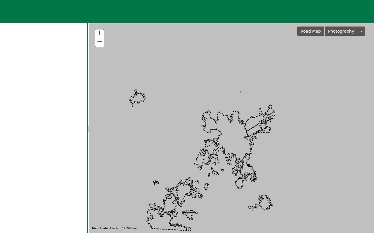
Map geometry is a discovery tool, not a survey or an ownership decision. Follow a visual match with the parcel card and the recorded deed or plat.
Note: The county GIS service reports map layers, while the recorded document remains the source for a legal parcel description.
Salisbury Address Deed Trail
After the parcel card supplies a book/page or legal-description lead, use the Rowan deed index. Its inspected results include date filed, index, kind, grantor, grantee, description, license number, book/page, reference, amount, and image controls. The index can require an account or normal browser features. It is not the only access channel: the Register counter can direct requests for archived books or images, and the office phone is 704-216-8626.
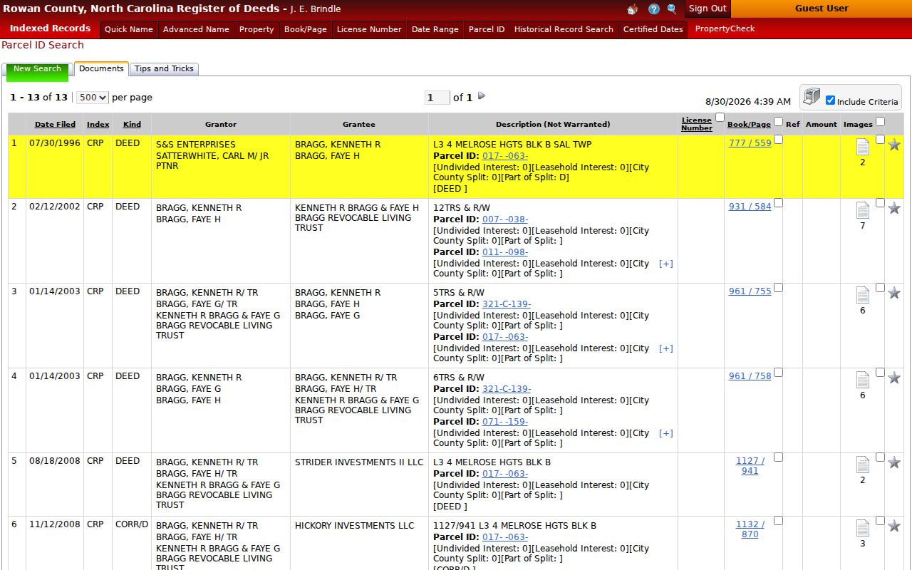
The certified-date table inspected on August 29, 2026 reported pre-1975 land records from April 12, 1753, land records from 1975 forward, and current endpoints certified through August 27, 2026. These are coverage labels, not a promise that every image or index entry is complete. The portal’s historical image notice identifies 1753 to 1875 Record Books 1 through 50. Work backward from the current instrument, using grantor, grantee, prior reference, plat book/page, easement, and legal-description clues.
The Register’s index labels its description “Not Warranted.” Read the image and cited plat rather than relying on the result row. A court case and a land instrument may also be separate records, so a book/page and case number should be kept as different references.
Salisbury Address Records Compared
Address-keyed sources overlap, but their roles should stay distinct. The following record map follows the way Rowan County and Salisbury divide property, geography, election, and service information.
| Address record | Custodian | What it can show | Access path |
|---|---|---|---|
| Real-property profile | Rowan County Tax Assessor | Parcel, situs, owner, mailing address, tax details, land use, and transactions | Online form, phone, or counter |
| Parcel and address layers | Rowan GIS and Salisbury GIS | Parcel geometry, address point, streets, limits, neighborhoods, and zoning context | Public map services |
| Recorded land index | Rowan Register of Deeds | Grantor, grantee, filing date, book/page, reference, and document image route | Index, account boundary, counter, or office request |
| Voter information | NC State Board of Elections and Rowan Board of Elections | Public election fields subject to statutory protections | Official lookup, files, list request, or county office |
| Permit or code activity | Rowan CSS and Salisbury One Stop | Permits, plans, inspections, code cases, requests, and licenses | Public search, walk-in help, or focused request |
The county public-record request form is an umbrella router. Name the department, address or parcel, date range, record type, and desired format. It directs court, Register, CAD/radio, and body-camera matters to specialized paths, so it does not replace an office-specific request.
Salisbury Street Addresses and Limits
A Salisbury mailing label, a ZIP result, and a parcel inside municipal limits are not interchangeable. Salisbury GIS presents City Limits, the Rowan County Boundary, and Non-Annexation Boundaries, while the county handles the assessor and deed layers. Use both map systems when jurisdiction affects the records search. The city map catalog is a helpful second view of city-specific tools.
The Salisbury GIS maps catalog is the source for this view.
The city warns that its maps are approximate and should be checked against deeds and plats. That warning matters at a boundary, where a map label or postal city can otherwise be mistaken for a legal municipal location.
Salisbury Street Permit Records
Permit and service records can add a dated activity layer to an address, but they are not resident records. Rowan CSS public search covers permits, plans, inspections, code cases, requests, and licenses. Its documented controls include Exact Phrase, Search, Filters, and Export. Salisbury’s permit and zoning route offers one-stop assistance, portal access, and walk-in help. Record the case type and date, then ask the responsible office about any restriction or missing file.
A request under the North Carolina Public Records Act should seek an existing, date-bounded record. Chapter 132 supports inspection and copying of existing public records, but it does not require an agency to create a new compilation, and statutory confidentiality can limit release. For street research, a precise address, date span, and record category is much more useful than a broad request.
Salisbury Address History
Historic address work needs three separate strings whenever they exist: the historical address, current situs address, and owner mailing address. Older Rowan records may use township, block, lot, subdivision, landmarks, or a legal description instead of a modern number. A legal-description fragment can retrieve an instrument that a street-name search misses. The inspected deed-index schema can carry township/block/lot wording as well as book/page references.
Sanborn maps add a building footprint and block context, not a household list. The Library of Congress holds a 1896 Salisbury map set by sheet. Pair a sheet with street geometry, legal description, tax-card transaction clues, and the Register image. A footprint match does not prove that the same household occupied the building. For the publication shelf itself, the Salisbury Directory Book is the appropriate route for dated directory collections.
Rowan was formed in 1753 and its present boundaries stabilized by 1836. An early Rowan deed, will, or court minute may concern a place outside modern Salisbury or present Rowan County. Preserve the original place label and record year rather than silently converting it to a current location.
Salisbury Street Directory Record Terms
Address records use labels that look alike but mean different things. Keeping them separate prevents a tax field or map line from being stretched beyond what it supports.
- Parcel
- A tax and mapping unit used to connect an assessor profile, GIS shape, and deed references. It is not a list of everyone at the address.
- Situs address
- The property’s physical location on the tax record. It can differ from the owner mailing address.
- Plat
- A recorded map or plan cited by a deed to describe lots, boundaries, rights-of-way, or subdivision details.
- Criss-cross directory
- A dated reverse-style directory arranged to help connect an address with a listed entry for that publication year.
Use role labels in notes: owner, grantor, grantee, voter record, case party, or directory entry. When the goal becomes verifying one specific person rather than following the location, use the Salisbury Resident Lookup route and keep each official source in its proper role.
Salisbury Voter Address Limits
The NC State Board of Elections voter lookup requires first and last name, with optional middle initial, birth year, county, and status choices. Results can provide registration status, jurisdictions, polling place, sample ballot when available, absentee information, and voter history. The data is useful for an election record tied to a known identity, but it cannot be used as a street keyword directory. Rowan’s Board of Elections offers office assistance at 1935 Jake Alexander Boulevard W in Salisbury.
North Carolina law identifies public voter fields such as name, address, age, party, precinct, districts, and history, while full date of birth, Social Security numbers, driver-license information, email, and other fields are protected. A removed or inactive status is an election-status field, not a statement about where someone lives. Voter-history data does not reveal candidate or ballot choices.
Note: Preserve the source date and status because voter files refresh and address protection can change what public results display.
Salisbury Property Check Limits
Rowan Property Check is a free recording-alert service. After account setup, it can watch a property, owner name, or parcel ID and send text or email alerts. Its purpose is early notice of a potential recording issue. It does not stop a filing, prevent fraudulent recording, determine a document’s validity, or replace a review of the recorded image. The Register directs suspected issues to the office and local law enforcement.
This limit is important when a new deed, lien, or other filing appears in an address search. Save the alert date, then verify the book/page, index details, image, and any related plat or prior reference through the Register.
Salisbury Street Directory Privacy Boundaries
North Carolina public access is subject to field-level protections and agency redactions. The Address Confidentiality Program provides a substitute address for qualified participants, including people affected by domestic violence, sexual assault, stalking, or human trafficking. A protected or substitute address is a stop condition, not an invitation to piece together location clues across property, voter, GIS, or postal sources.
Public records can be outdated, indexed imperfectly, or tied to a role other than residence. Confirm a needed fact with the office that holds the source, and do not turn an owner, voter, directory, or mailing field into a claim about current occupancy.