
Salisbury ZIP Code Directory Coverage
The North Carolina Department of Revenue ZIP table provides the cleanest starting set: 28144, 28145, 28146, and 28147 are assigned to Rowan County for Salisbury. The table is an administrative sorting reference, not a live delivery map. It does not establish an address-by-address city boundary or confirm that anyone is at a particular location. For that reason, the areas and postal labels below should be verified through USPS and then checked against local assessor and GIS records.
| ZIP | Areas covered | Post office | Notes |
|---|---|---|---|
| 28144 | Salisbury ZIP assigned to Rowan County in the DOR table | Downtown Postal Unit is listed for this ZIP | Postal unit services do not prove street-delivery coverage for every address. |
| 28145 | Salisbury ZIP assigned to Rowan County in the DOR table | Confirm the recognized postal label in USPS lookup | Use an address result before assigning a delivery conclusion. |
| 28146 | Salisbury ZIP assigned to Rowan County in the DOR table | Confirm the recognized postal label in USPS lookup | Postal bulletins document Salisbury and China Grove labeling changes. |
| 28147 | Salisbury ZIP assigned to Rowan County in the DOR table | Confirm the recognized postal label in USPS lookup | Postal bulletins document Salisbury and China Grove labeling changes. |
There is no official address-by-address table in the research identifying every ZIP and city-limit mismatch. The careful result is a field-by-field comparison, not an assumed neighborhood boundary.
Salisbury ZIP Code DOR Starting Point
The North Carolina Department of Revenue ZIP table is valuable because it places all four Salisbury ZIP codes in Rowan County. Use it to set the county context at the start of a records search. It should not replace current Postal Service recognition, property research, or a municipal boundary check. Delivery routing, recognized city names, ZIP+4 values, carrier routes, and annexation can change after a reference table is published.
Retain the source date and the exact ZIP from the record being checked. A historical directory may display a postal label that differs from a current USPS response. Preserve the old label and year instead of modernizing the entry without a source.
Salisbury ZIP Code USPS Checks
USPS ZIP Code Lookup offers By Address, By City and State, and Cities by ZIP modes. The address form accepts company, street, apartment or suite, city, state, and ZIP fields; city/state and ZIP modes serve different verification tasks. USPS expressly says that a result does not confirm a person or company at an address. It validates postal recognition and routing format, not residency.
The USPS lookup is the source shown below. Use it after recording the address exactly as given, including an apartment or suite when present, rather than filling an unknown detail from another source.
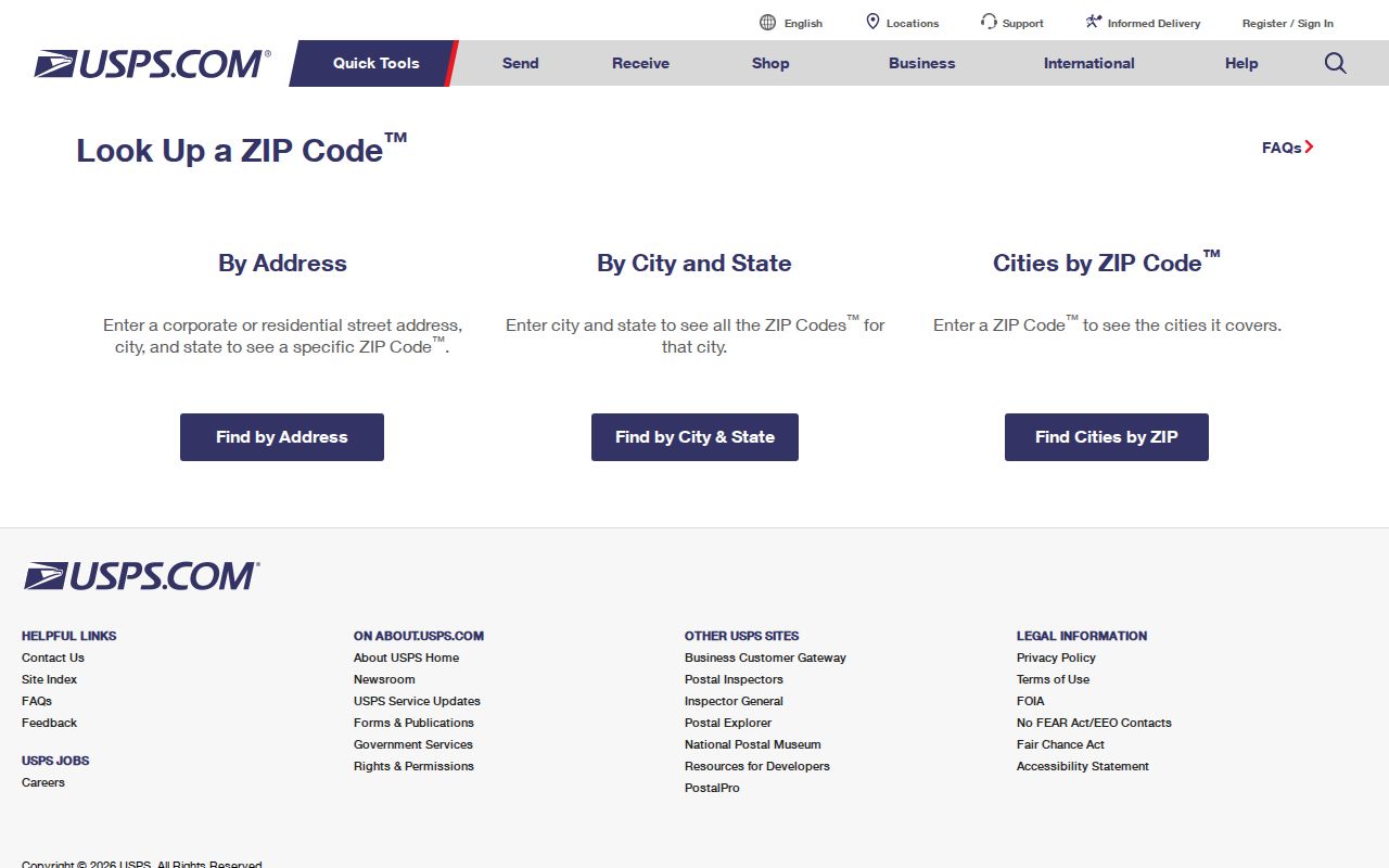
A returned postal city can help normalize a mailing string. It does not decide whether the parcel is inside Salisbury municipal limits, and it does not identify the person associated with the address.
Salisbury ZIP Code Assessor Searches
Rowan County provides two ZIP-capable property routes. The real-property search includes ZIP among address, parcel, owner, account, book, and page options. A separate mailing-address search has Street, ZIP Code, and CID fields, plus sort, result-count, and page controls. The mailing route uses its own data-current date. It should remain separate from a property situs search because a mailing destination can be a tax notice address, a PO box, a government office, or an address different from the parcel.
| Search route | ZIP-related field | What to retain |
|---|---|---|
| Real-property search | ZIP | Returned parcel ID, situs address, tax year, and the source date. |
| Mailing-address search | ZIP Code | Street, ZIP Code, CID, displayed data-current date, and whether the result is mailing only. |
| Parcel profile | Property and mailing addresses | Separate property/situs and owner-mailing values rather than collapsing them into one address. |
The assessor mailing-address search is the official source shown below. Its one-field guidance means a ZIP-only result may be broad. Record the field used, then test a possible false positive against the street, parcel, or account number.
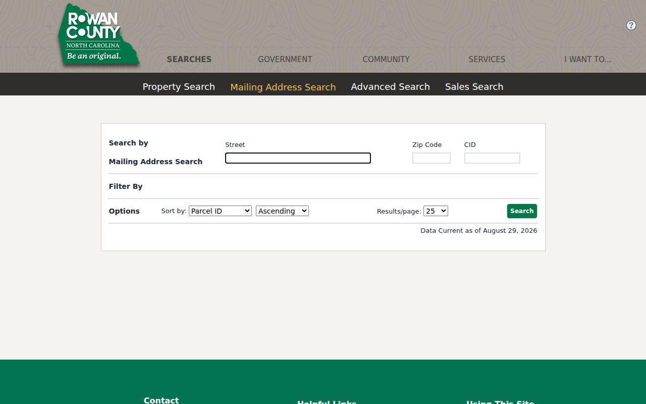
The Assessor’s general phone is 704-216-8558 and land-records phone is 704-216-8566. Those routes are useful when maintenance messaging or an incomplete result prevents a repeatable search.
Salisbury ZIP Code Search Workflow
A ZIP narrows geography. It does not establish a household. Work through the official postal, property, and map layers in order, then move to an address-level record only when the result supports it.
- Start with the DOR table and record whether the search concerns 28144, 28145, 28146, or 28147 in Rowan County.
- Use USPS By City/State or Cities by ZIP to check the recognized postal label, then use By Address for a complete address.
- Search the assessor’s real-property or mailing-address field with the documented ZIP control, retaining the returned address type.
- Open Rowan and Salisbury GIS layers to compare the parcel with city limits, county boundary, and non-annexation boundaries.
- Once a particular address is confirmed, use the Salisbury Street Directory for the parcel, deed, map, and dated-address chain.
This sequence documents what each source actually supports. It avoids turning a postal result into evidence of municipal status, ownership, or current occupancy.
For a repeatable record note, capture the ZIP, ZIP+4 when USPS returns one, recognized city, address type, parcel ID if used, source title, and access date. Keep the assessor mailing ZIP apart from the property/situs ZIP. A result may involve several tax districts, towns, rural areas, or parcel types, so a ZIP-only match needs a street, parcel, or account check before it is treated as the intended location.
Salisbury ZIP Codes and City Limits
Postal geography and municipal geography are separate systems in Salisbury. Salisbury City GIS exposes Salisbury City Limits, Rowan County Boundary, and Non-Annexation Boundaries. County GIS and the assessor cover the county-wide parcel layer. Therefore, “Salisbury, NC” in a mailing address, “Salisbury” as a USPS-recognized city, and “inside Salisbury municipal limits” should be kept as three different fields.
ZIPs 28146 and 28147 illustrate why that split matters. Research found postal bulletins concerning Salisbury and China Grove labeling changes, while city-limit status requires the local map and parcel check. Do not infer a city boundary from the ZIP alone.
Salisbury ZIP Code Directory Terms
Postal labels are useful only when the type of value is clear. These terms keep a ZIP search from being mistaken for parcel or city-boundary research.
- ZIP Code
- A Postal Service routing code. It can cover more than one locality, tax district, or municipal area.
- ZIP+4
- An added four-digit routing detail returned for a particular delivery point. It can change and does not prove residency.
- PO-box ZIP
- A ZIP associated with postal box service. It should not be assumed to describe a street-delivery area.
- Unique ZIP
- A ZIP assigned to a single organization or delivery arrangement. No Salisbury unique ZIP was identified in the research.
- Carrier route
- A Postal Service delivery grouping, separate from a legal parcel line or municipal boundary.
Keep a historical street label, current property/situs address, and owner mailing address as separate values where the records provide them. This three-address discipline prevents a tax mailing destination from being presented as a present physical location.
Salisbury ZIP Code Voter Files
The state voter system is not a ZIP keyword search. Its online lookup requires a person’s first and last name, with optional middle initial, year of birth, county, and status. Public registration files can include current or removed status, reason, demographics, party, residential and mailing address, county, precinct, and district. Current files refresh weekly on Sunday, and the separate voter-history file does not stand alone as a name or demographic source.
North Carolina law protects full date of birth, Social Security numbers, driver-license data, email, photo-ID copies, and protected addresses. A removed or inactive field is an election status, not an assertion about present residence. When a ZIP is part of a lawful, election-related search, retain its source date, field type, and the statutory limit.
Salisbury ZIP Code Historical Labels
Older documents should retain their original postal and place language. Rowan County’s geography has changed over time: the county was established in 1753 from Anson and its current boundaries stabilized by 1836. An early Rowan location does not automatically match modern Salisbury or present Rowan County. Later directories, maps, tax cards, and postal labels each have their own date and purpose.
For a historic address, use a Sanborn sheet and building footprint only as a bridge to street geometry and legal description. The footprint does not identify a household. Pair it with a dated directory, tax-card transaction reference, and recorded document when those sources are available.
Note: A current USPS label may differ from a historical entry, so preserve the source year before comparing postal formats.
Salisbury ZIP Code Directory Limits
North Carolina public-record access has field-level limits. Under the Public Records Act, agencies generally provide inspection or copies of existing public records, but they can redact confidential fields and do not have to create a new record. A postal lookup cannot confirm a person or company at an address, and a tax owner, mailing address, or voter field cannot by itself establish current occupancy.
The North Carolina Address Confidentiality Program uses substitute addresses for qualified participants. If a source indicates address protection or a protective-order limit, stop address triangulation and use only the official program explanation and safe agency contact. Do not combine property, voter, GIS, or postal clues to complete the location.